Preserving the past and heritage of this wonderful village at the heart of the New Forest
Brockenhurst from above
Pictures taken from airplanes have shown the contiunmual evolution and development of the village.

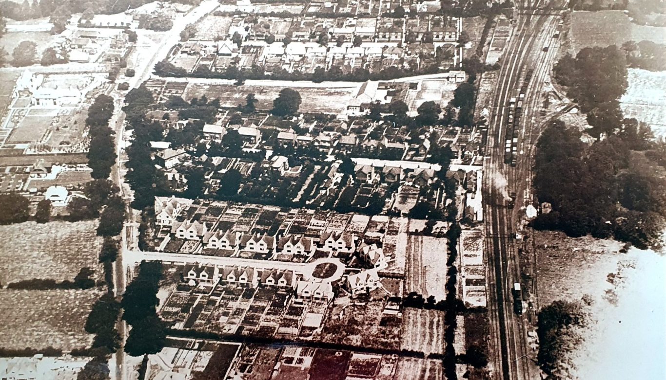
Aerofilms. 1925.
Looking North along Sway Road with new developments such as Addison Road, at the bottom. On the left of Sway Road is mainly fields. The County Secondary School in Highwood Road (now the Village Hall) is clear, as is, the otherside of the railway, the turntable where steam engines could be turned to face the other direction.

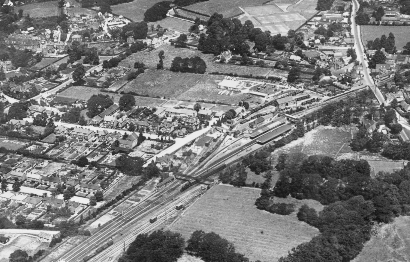
Aerofilms. 1925.
Lyndhurst Road runs up the right of this picture. Beyond the station there are fields, stables and the Brokenhurst Manor Concrete Block Company, started by the Morant Estate to provide jobs are the First World War. The tennis courts, behind the Morant Hall, hosted the pre-Wimbledon national championships until 1939.

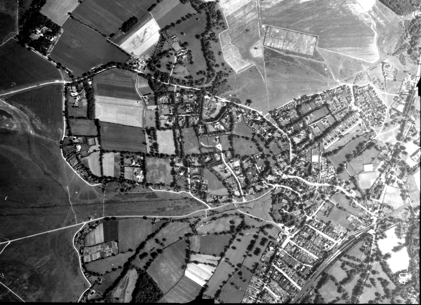
Royal Air Force. 1945
The village in 1945 reveals many fields where modern development has taken place such as new Forest Drive in the centre. At the top the allotments are clear, twice the size of now.

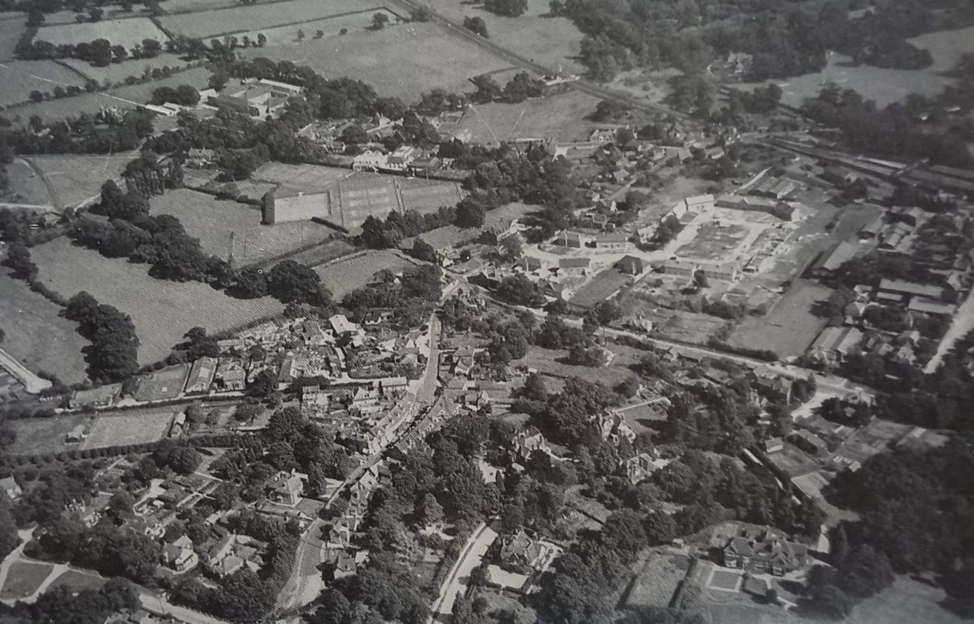
Photographer unknown. 1953-54
Brookley Road runs from the bottom (watersplash) with Sway Road in the middle. The main feature is Auckland Avenue, being built when this picture was taken. Several large houses have now vanished, such as Brookley House (corner of Sway Road and the Rise) and Culverley House (now a private development overlooking Culverley Green).
© Website copyright David Bennett and Brockenhurst Heritage 2025. All rights reserved.
We need your consent to load the translations
We use a third-party service to translate the website content that may collect data about your activity. Please review the details in the privacy policy and accept the service to view the translations.